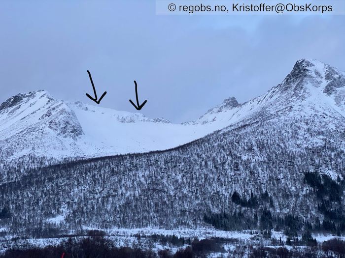
Image 1 of 6 Of: Avalanche Activity Copyright: Kristoffer@ObsKorps Comment: Pilene peker på området hvor skredene har startet. Anslår begge å være str. 2, retning SØ, 600-700 moh.
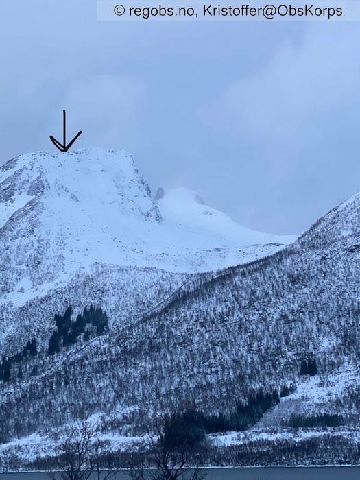
Image 2 of 6 Of: Avalanche Activity Copyright: Kristoffer@ObsKorps Comment: Samme på dette bildet. Str. 2, retning Ø, høyde mellom 600-700.
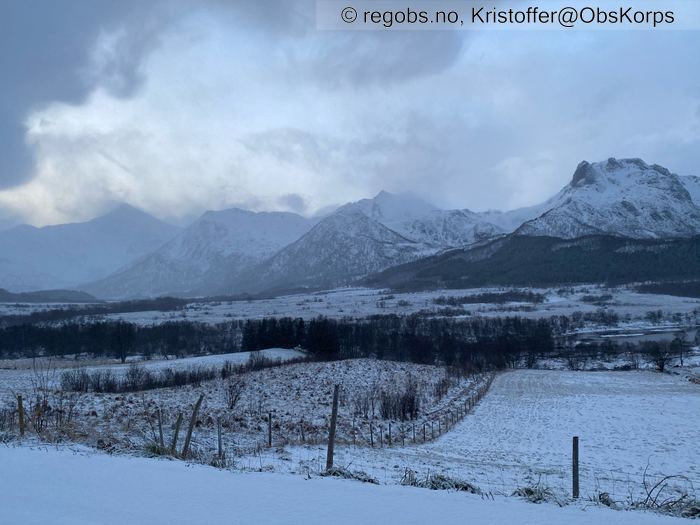
Image 3 of 6 Of: Weather Copyright: Kristoffer@ObsKorps Comment: Bilde tatt på Oshaugen i Eidsfjorden mot SV. Som sagt så er det en del vind og det vises på snøtransporten fra fjellene.
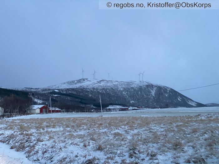
Image 4 of 6 Of: Snow Cover Copyright: Kristoffer@ObsKorps Comment: Ånstadblåheia i Sortland kommune er preget av kraftig mildvær og regn. Svært lite snø igjen.
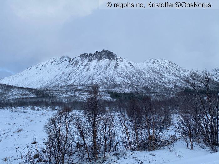
Image 5 of 6 Of: Snow Cover Copyright: Kristoffer@ObsKorps Comment: Rismåltuva (Toppen lengst til venstre), som er SV-vendt, innerst i Hognfjorden har også lite snø. Ligger litt mer igjen i rennene.
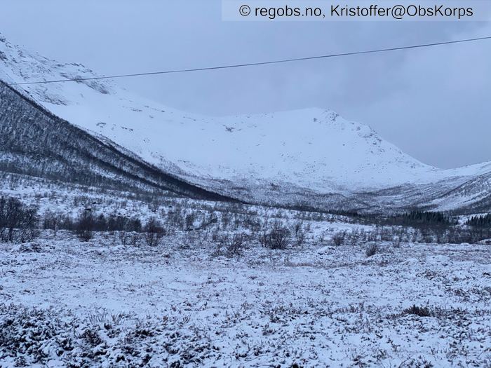
Image 6 of 6 Of: Snow Cover Copyright: Kristoffer@ObsKorps Comment: En dal på vestsiden av Godfjorden. Den har vært godt skjermet fra værretningen, så det er fremdeles en del snø igjen oppi sidene. Bilderetning V.
Danger Sign
• Recent snowdrift • Område: Fylket/varslingsregion. Beskrivelse: Kraftig snøfokk på mange topper. Fersk fokksnø der det har kommet snø de siste 24 timene.
Avalanche Activity
• 2. Jan. During the day (+01:00) • Several (6-10). 2 - Medium. Spontaneous release • Some steep slopes. E, SE. Above 500 masl • Ser det har gått flere skred. Dårlig lys gjør det vanskelig å identifisere skredtype, men går ut i fra at dette er flakskred som har gått under mildværsperioden de siste 48 timene.
Weather
• Snow • 0.5 °C • 8 m/s from SW ↗ • 50% clouds • Bygevær nå. I løpet av de siste 18 timene har det gradvis blitt kaldere og nysnøgrensen har krøpet nedover i takt med det. Har vært og er fremdeles en del vind i kombinasjon med snøen som kommer.
Snow Cover
• Heavy snow drift • Elevation of new snow 0 masl. Layered snow begins at 400 masl • Some loose snow (1-10cm) • Dry • Mildværet som har herjet siste 48 timene har trolig fuktet snødekket helt opp til toppen i regionen. Toppene over 900 moh har kanskje berget seg, men det er nå ikke så mange av de. Ellers så har mildværet smeltet mye av snøen opp til 400-500 moh i sørlige og vestlige sider som var vendt mot været. Mye mer snø i sider som har vært skjermet. Der det fra før lå lite snø er det ingenting av betydning igjen. Snøen som kommer nå legger seg på en fuktig overflate.
Avalanche Problems
• Dry slab avalanche • Poor bonding between layers in wind deposited snow • Within half a meter • The overlying slab is soft. • Easy to trigger • 1 - Small • Some steep slopes N, NE, E, SE, NW above 500 masl • Aktuelt skredproblem nå vil nok være hardhetsforskjeller (sjiktoverganger) i den ferskeste fokksnøen. Da det er ikke kommet så mye anslår jeg str. til å være 1.
Avalanche Danger Assessment
• Mildværet har nøytralisert alt som tidligere var skredproblem heøt opp til ca. 900 moh. Det som utgjør skredfare nå vil være den helt ferskeste fokksnøen. Så lite snø under 400moh at skredproblemet er nok ikke aktuelt før man kommer seg opp til den høyden. Kan finnes lavere der det fremdeles ligger en del snø. Mulig det fremdeles er så mye vann i snøen i lavlandet at det går an å trø ut noe der. • Med videre snøvær og vind så vil nok fokksnøproblematikken vedvare og skredstørrelsen vil gå opp. • 1 Low • Skal være litt forsiktig å kommentere varselet da jeg ikke har vært i terrenget, men med den ferske fokksnøen som dannes nå så tror jeg ikke faregraden minkes med det første.

